A map of Chicago’s Gangland circa 1931
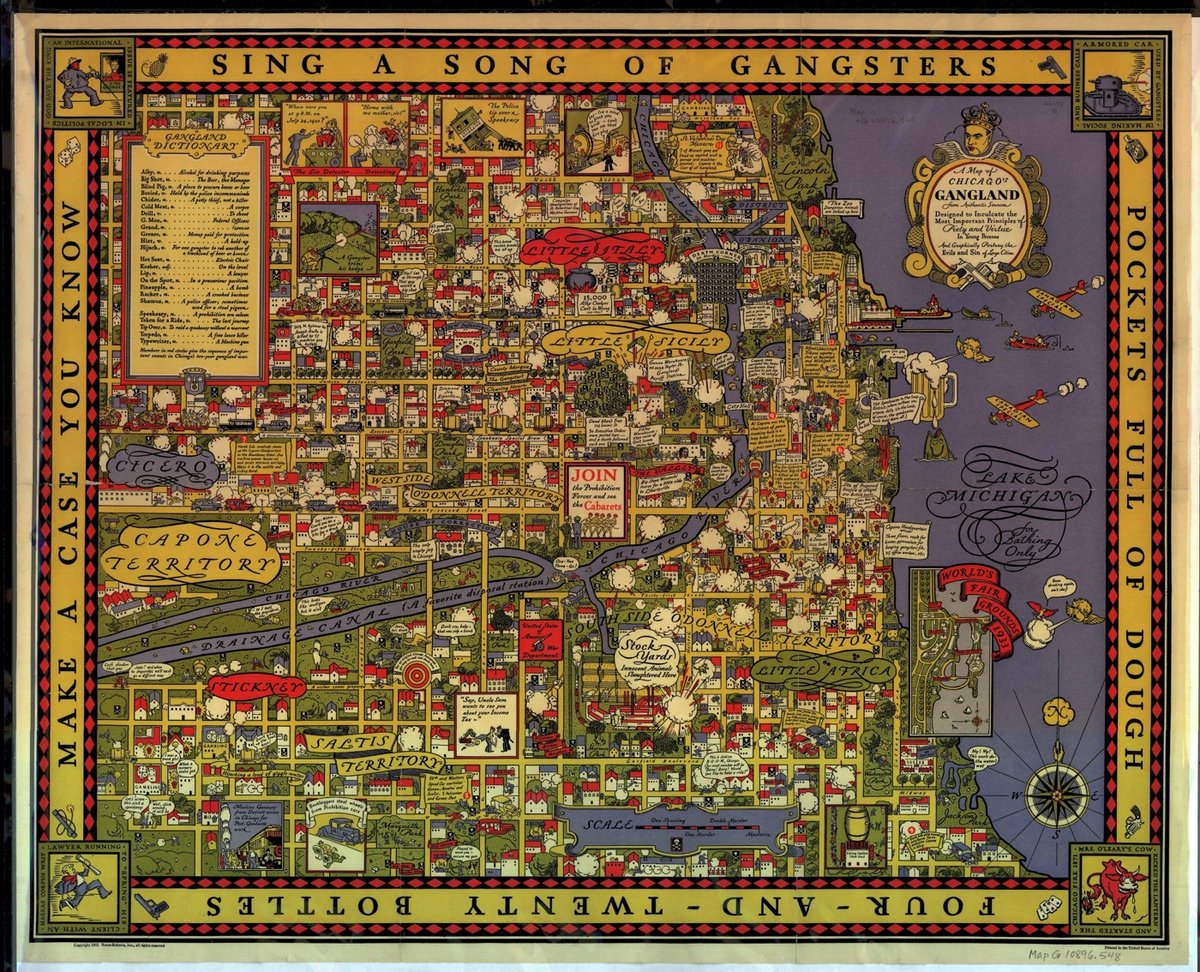
This is A Map of Chicago’s Gangland from Authentic Sources published in 1931 by Bruce-Roberts, Inc.
Map of Chicago gang locations showing Little Italy, Little Sicily, Cicero, Capone Territory, Westside O’Donnell Territory, Stickney, Saltis Territory, Southside O’Donnell Territory, and Little Africa. “Designed to inculcate the most important principles of piety and virtue in young persons, and graphically portray the evils and sin of large cities.” Numbers in red circles give the sequence of important events in Chicago’s gangland war. Insets include: Mrs. O’Leary’s cow, lawyer running to spring his client, an armored car, bootleggers stealing wheels from prohibition cars, machine gunners arriving from Detroit, World’s Fair grounds of 1933, police tipping over a speakeasy, and “gangland dictionary”.
Al Capone looms large over the map; he was arrested for tax evasion that year and sentenced to 11 years in federal prison. There’s also a zoomable reproduction you can explore at the David Rumsey Map Collection.
Update: See also these historic vice maps of Chicago depicting “all of the bars, dives, brothels, saloons, pool halls and gambling houses in the Levee and Little Cheyenne Districts of Chicago between 1870 and 1923”.
Stay Connected