The Inverted Grand Canyon
What would the Grand Canyon look like as a Grand Mountain, i.e. if its depth became its height? Not quite as Grand perhaps, but still pretty cool.
Some of my earliest memories of the place had to do with the trippy feeling of my eyes and mind trying to make sense of the scale. I had seen many mountain ranges and vistas, including some on the way, but the vast negative space played havoc with my perception of magnitude. I’ve felt it a few times since, but never like that first Grand Canyon overlook.
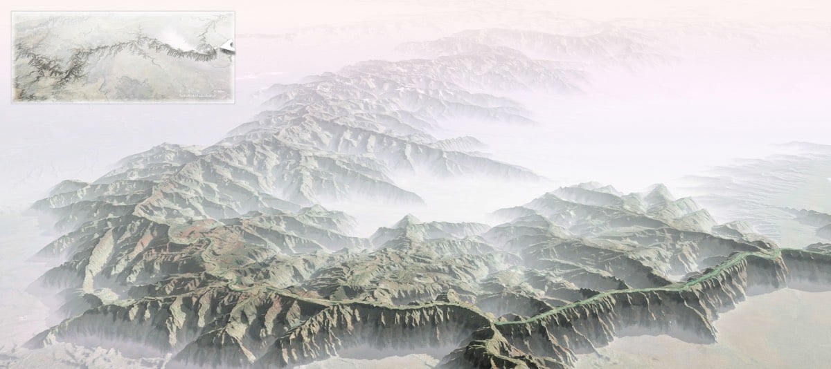
I wondered, then, if flipping the Grand Canyon into a Grand Mountain might in some way help me make sense of its scale. I’m much more accustomed to seeing the mass of something rather than the massive void of something. So, here’s what that looks like.
For reference, the depth at the deepest part of the canyon is ~6000 feet and the top of the canyon is between 6000 and 8000 feet above sea level, so the highest point of the Grand Mountains would be somewhere between 12,000 and 14,000 feet, in the ballpark of the Rocky Mountains. It would be fun to see what an inverted Kola Superdeep Borehole would look like: a 9-inch spire rising 40,000 feet into the air from a starting point very close to sea level, more that 10,000 feet higher than Everest.
If you want to dig into the details of how this visualization was made, check out this post on the ArcGIS blog. (thx, john)
Stay Connected