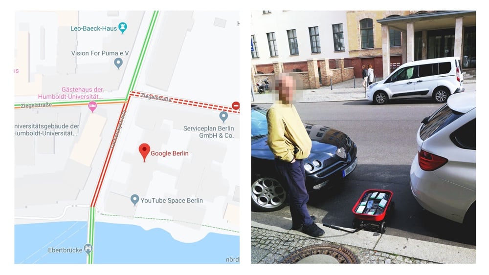
Hacking Google, a red handcart for red roads

You’ve got to love little artistic hacks like this. Simon Weckert put 99 second-hand smartphones in a red handcart and walked around a few blocks in Berlin. Each phone was running Google Maps and being tracked for trafic measurements. Their presence and slow rolling around the streets caused Google to display a traffic jam.
The advent of Google’s Geo Tools began in 2005 with Maps and Earth, followed by Street View in 2007. They have since become enormously more technologically advanced. Google’s virtual maps have little in common with classical analogue maps. The most significant difference is that Google’s maps are interactive - scrollable, searchable and zoomable. Google’s map service has fundamentally changed our understanding of what a map is, how we interact with maps, their technological limitations, and how they look aesthetically.
Stay Connected