Marshall Islands Navigation Charts
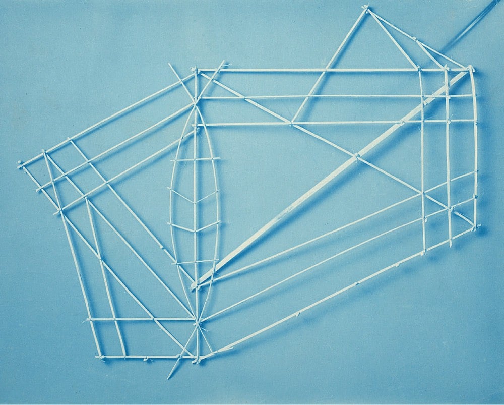
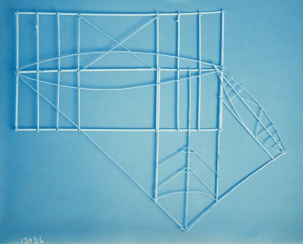
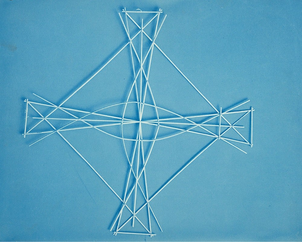
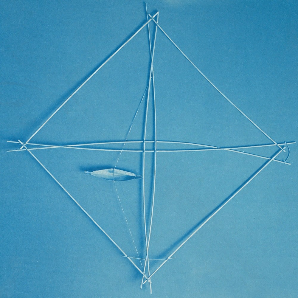
The arrangement of the sticks in these Marshall Islands navigational charts represents ocean swells & currents and how they interact with the land, useful information for navigating between islands via canoe. From a Smithsonian Magazine article about these charts:
The chart is less a literal representation of the sea, says museum curator and anthropologist Adrienne Kaeppler, and more an abstract illustration of the ways that ocean swells interact with land. Curved sticks, she explains, show where swells are deflected by an island; short, straight strips often indicate currents near islands; longer strips “may indicate the direction in which certain islands are to be found;” and small cowry shells represent the islands themselves.
The stick charts were preparatory & teaching tools — mariners would memorize the charts before heading out to sea rather than take them along on the boat.
The photos above are from the Smithsonian Institution, courtesy of Flickr.
See also Secrets of the Wave Pilots and other physical data visualizations. (via curationist)
Stay Connected