The Mediterranean Sea of America
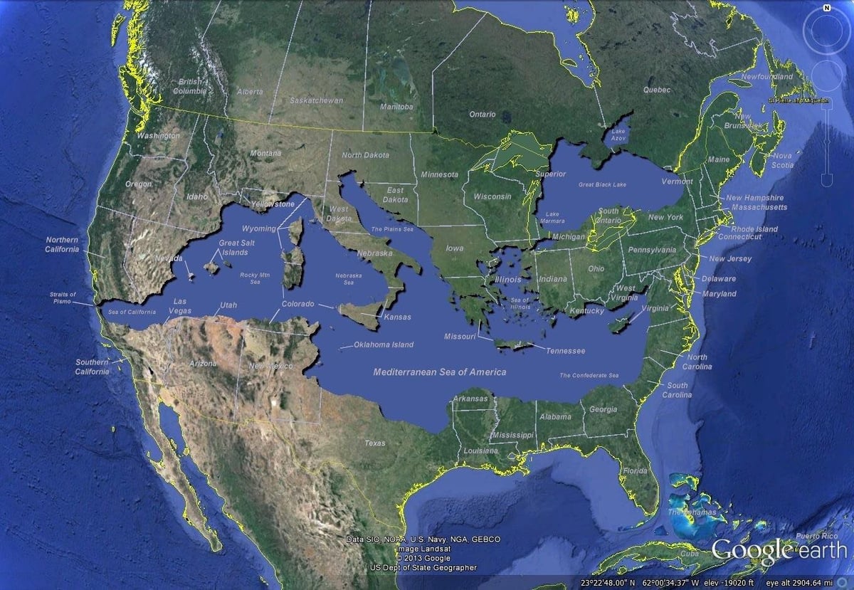
If you superimpose the Mediterranean Sea (and the Black Sea) over a map of the United States (map by Bret Drager) — creating geographic landmarks like the Confederate Sea, the Great Salt Islands, the Straits of Pismo, and a coastal Las Vegas — you get a real sense of how big each of them is. I confess, I didn’t think the Mediterranean Sea was this large. The other surprising thing is that the latitudes of the superposition are pretty accurate…only a degree or two off, if that.
You can try it yourself (and not just with the Med and US): the true size of things on world maps. And see also my old Manhattan Elsewhere project. (via fairly interesting)
Update: Lots of good geographical comparisons in this Twitter thread started by Maria Chong, including:
Italy is as close to Egypt as Kansas is to Florida.
Seattle is approximately Paris to the Aleppo (Syria) of Washington D.C.
The Trojan war was (probably) fought in the distance between Indiana and Missouri
When the Hebrews fled the Pharaoh in Egypt, it took them 40 years to get from somewhere in Florida to South Carolina
The Odyssey was a 10-year road trip from Indiana to California, then back to Missouri
Stay Connected