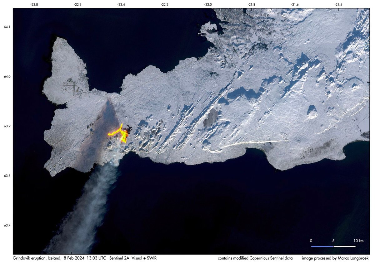
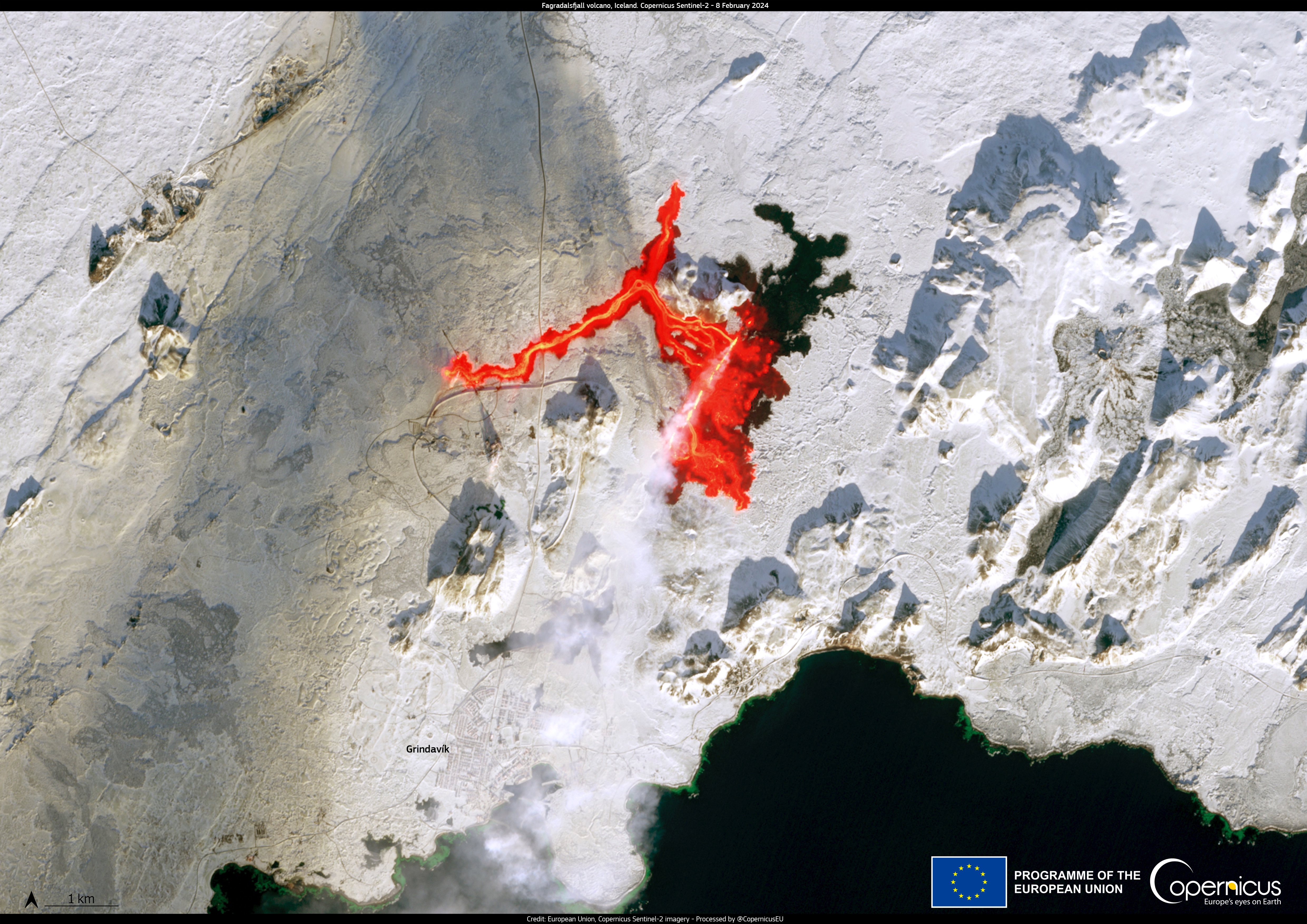
Wow. It’s worth clicking through to see it larger (mirrored here). You can see the Keflavik airport to the northwest of the fissure and Reykjavík is the darker area in the upper part of the image, just right of center. This image really underscores the extent to which volcanoes are fiery, slashing cuts to the Earth’s skin. It’s bleeding! Bleeding lava!
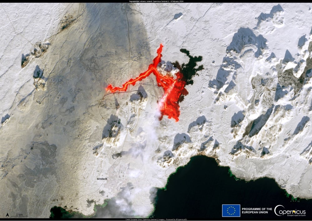
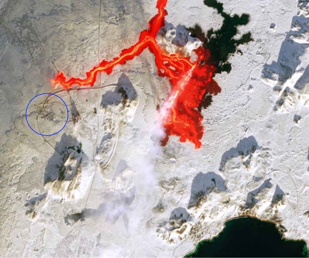
If you want to check out the satellite imagery for yourself, you can find it on Copernicus Browser. I tried for a few minutes to duplicate Langbroek’s view (“combined natural colour + SWIR”) but couldn’t quite manage it.
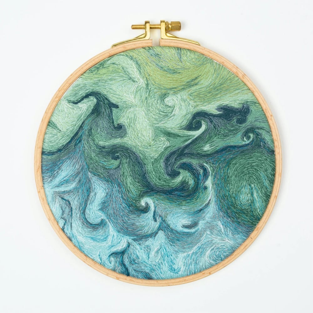
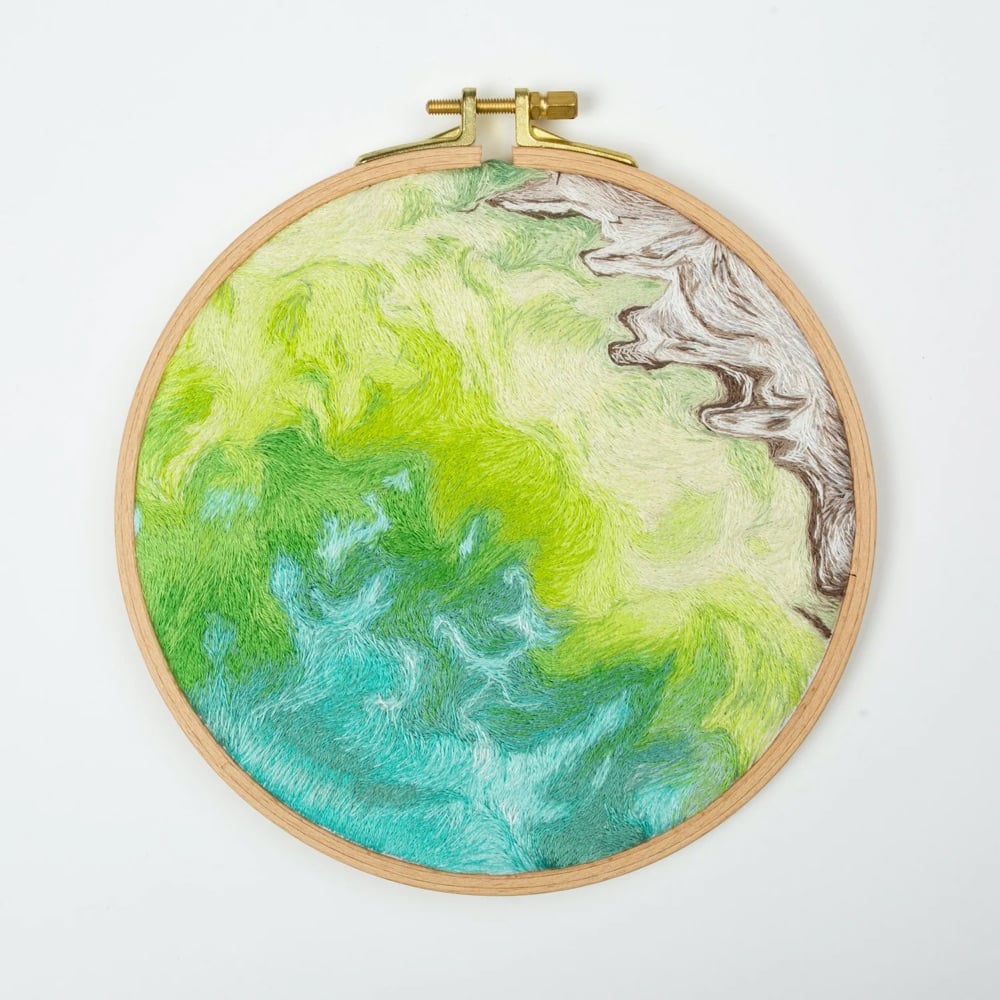
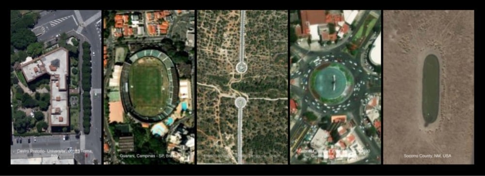
Danielle Currie’s intricate hand embroidered pieces capture the beauty of Earth from a satellite view. Each piece is named with the latitude and longitude coordinates, providing observers the opportunity to independently explore the area which inspired the piece.
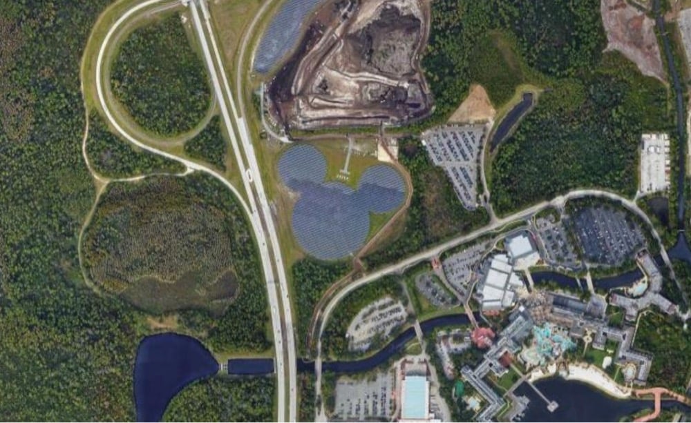
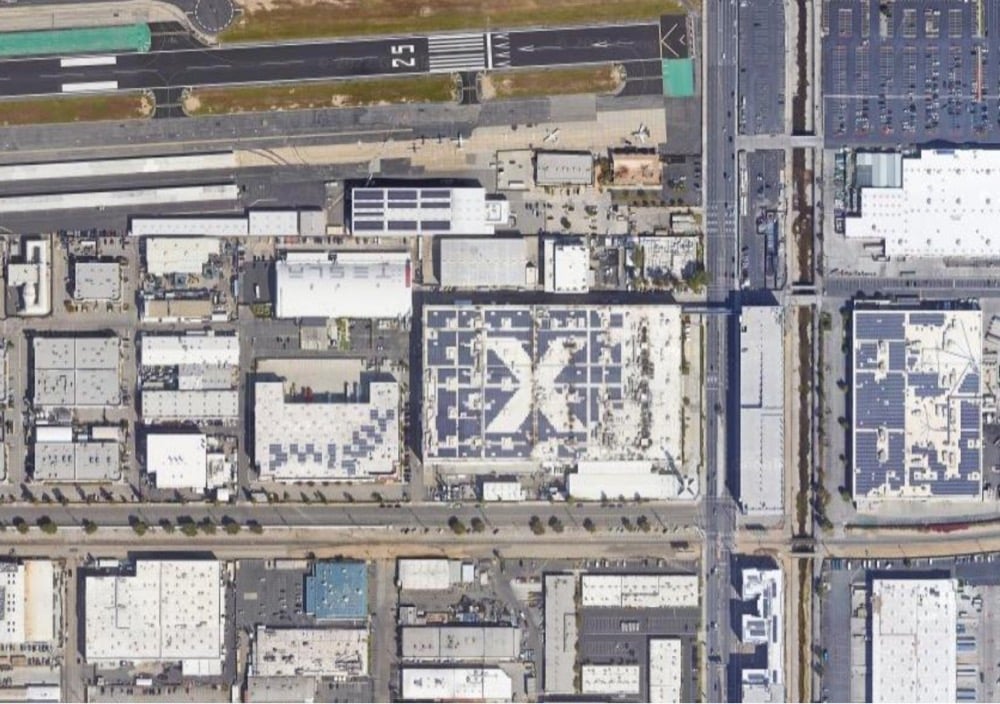
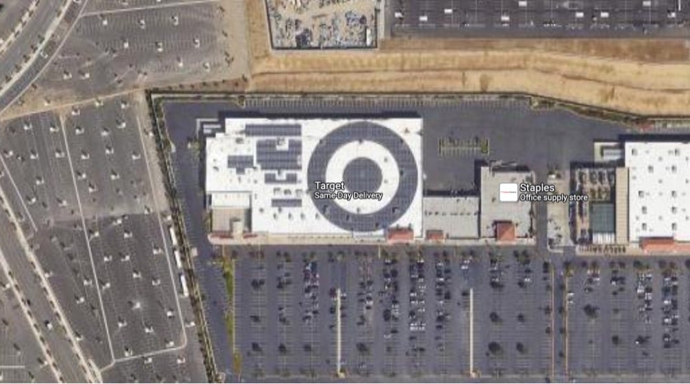
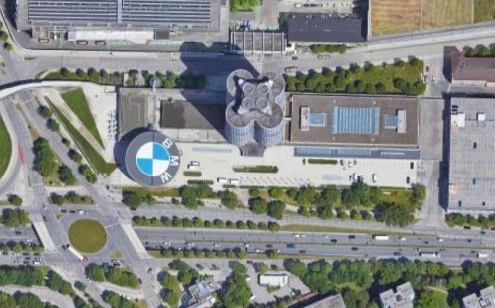
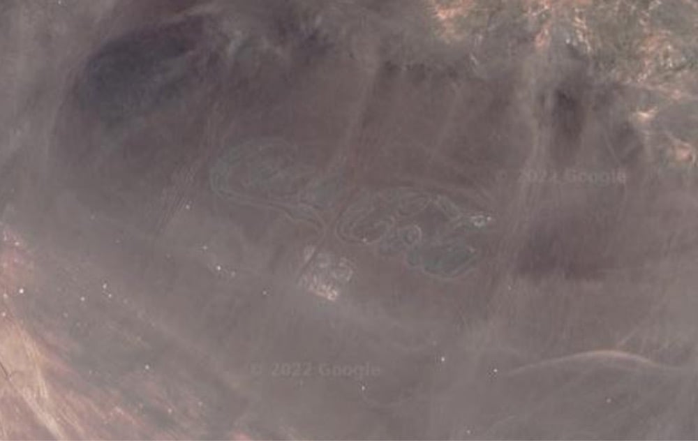
Elissaveta M. Brandon recently wrote about the uptick in companies placing huge logos, often drawn in solar panels, so that they can be seen in satellite imagery. I collected images of a few examples of logos that are viewable from space above: a solar array at Walt Disney World, an X on the roof of the SpaceX HQ, a Target logo on top of a Target store, the BMW Museum, and a huge Coca-Cola logo that’s been in the Chilean desert since 1986 (and is therefore difficult to see on satellite imagery). (via clive thompson)
Earth Clock is a digital clock where the digits are satellite photos of geographic and architectural features that look like numbers, complete with a colon in the middle. A few screenshots from this morning…you get the idea:
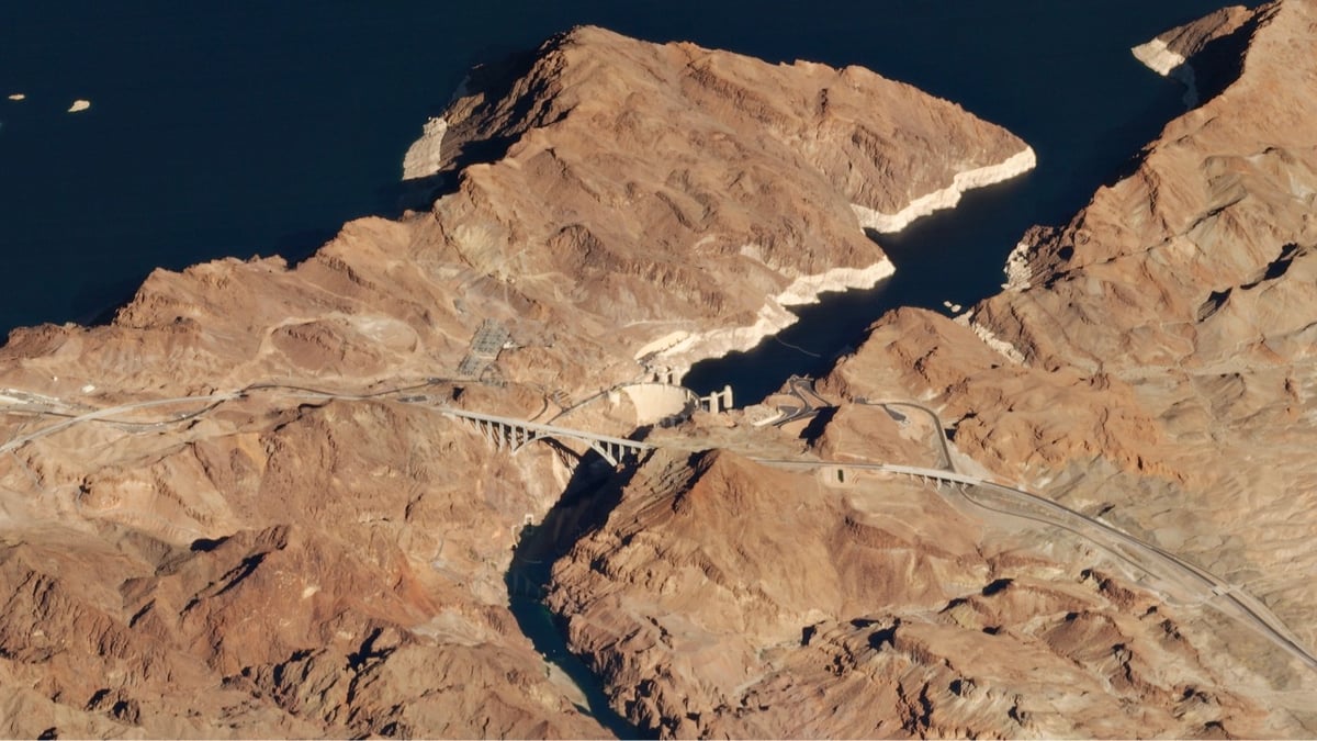
Aspreviouslydocumented, I am a big fan of satellite images taken from a low angle. Planet Labs’ Robert Simmon wrote a post that talks about the history and uses of low-angle satellite imaging and shares many examples (like the two above of the Hoover Dam and Paris).
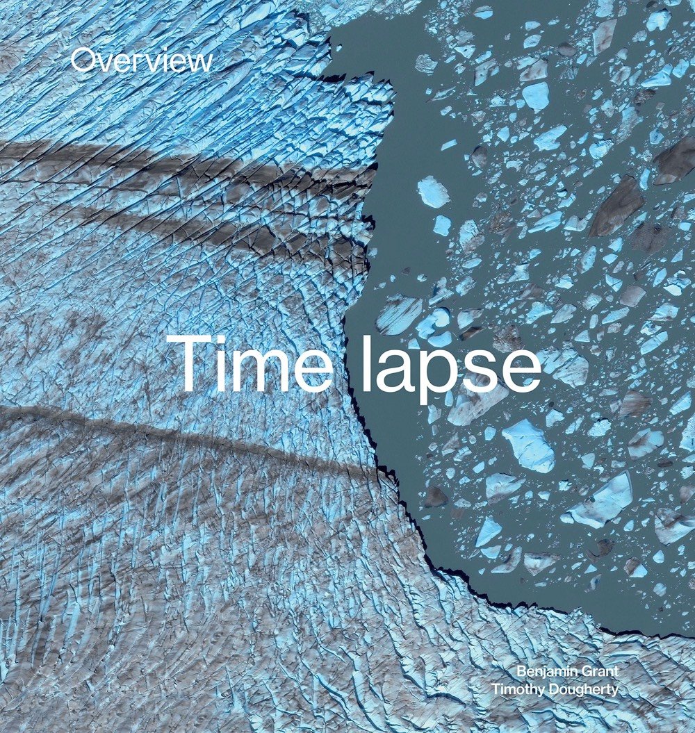
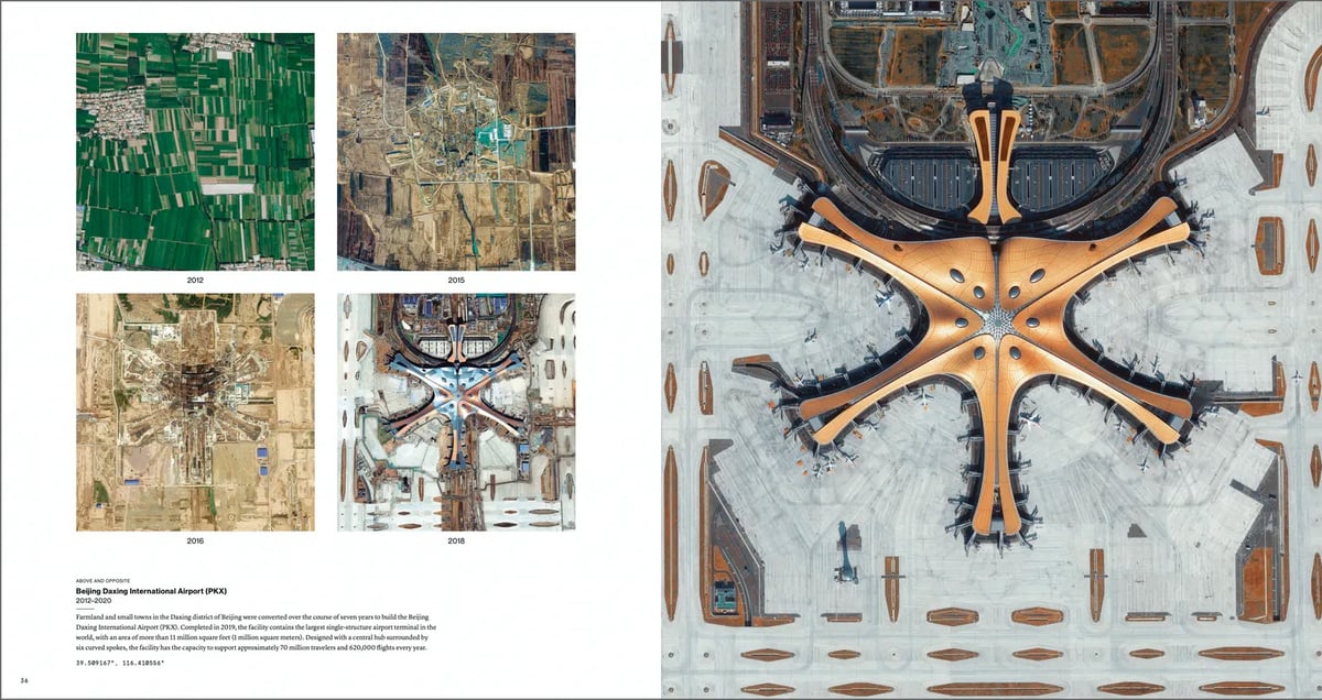
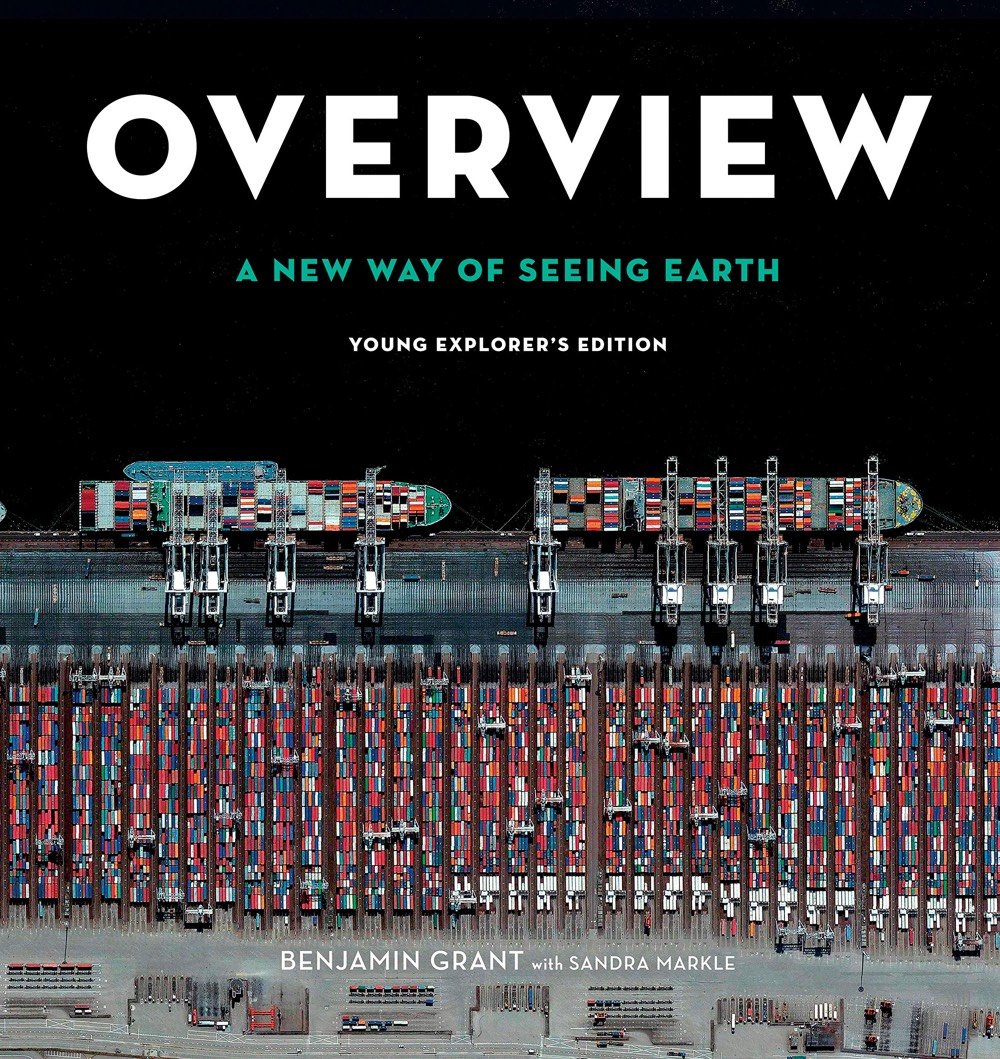
From the creators the Daily Overview website that showcases beautiful & educational satellite imagery of Earth, comes a new book about the Earth’s changing landscape. Overview Timelapse: How We Change the Earth is a book of satellite imagery that shows how landscapes change over time due to things like volcanic eruptions, climate change, population growth, and massive construction projects.
With human activity driving this transformation faster than ever, visible signs can now be seen across the planet. With more than 250 new, mesmerizing images such as sprawling cities and the patterns created by decades of deforestation, this book offers a fresh perspective of change on Earth from a larger-than-life scale.
Here’s a layout from the book that shows the construction of the Beijing Daxing International Airport over the course of several years:
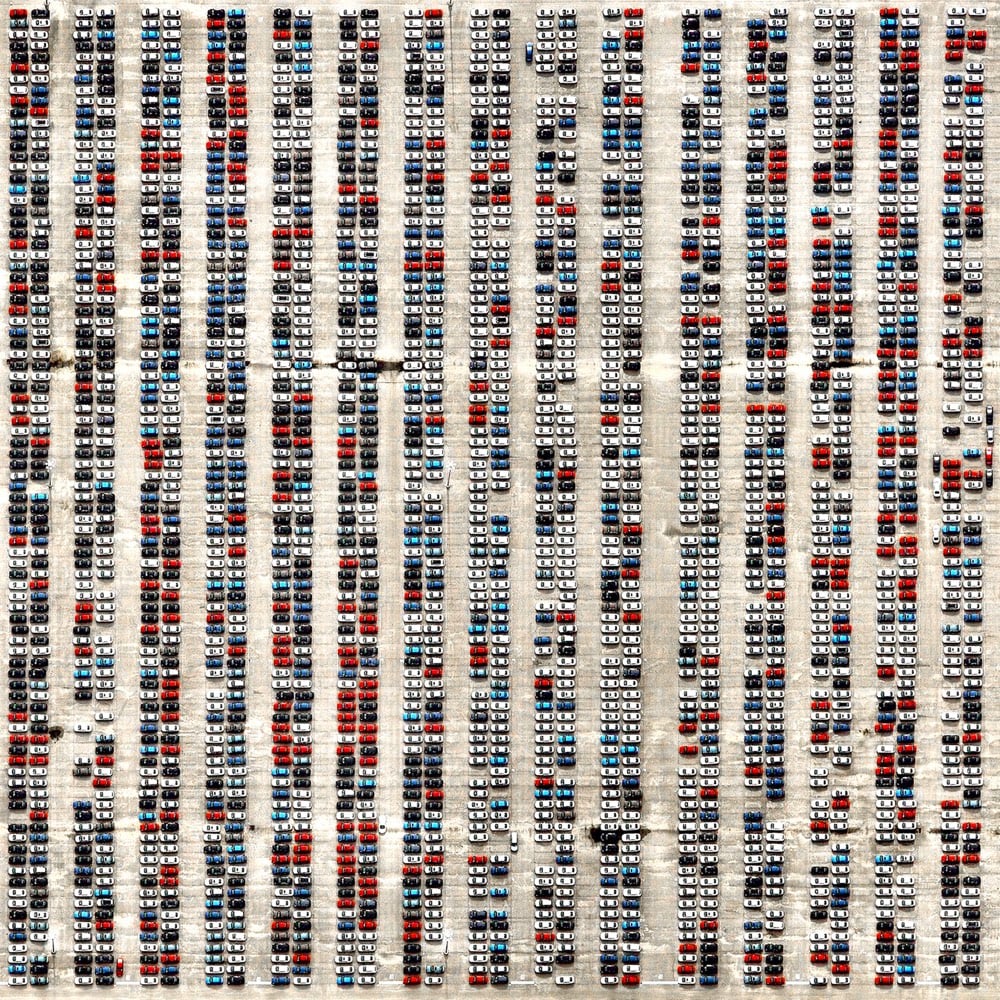
Automobiles make up 70% of the emissions from all forms of transportation. There are an estimated 1 billion cars on the planet, with around 80 million new cars sold each year. Despite continually strong sales, experts suggest we have reached ‘Peak Car’ — meaning the average distance traveled per person in cars has peaked, and will continue to fall over time. There are many different factors contributing to this trend, such as a global shift towards urban living, new forms of mobility, new government policies for reducing traffic, and a slowing expansion of road networks.
The first 30 seconds of this time lapse video provides a great look into how the 10 satellites that make up the Global Precipitation Measurement Constellation scan the surface of the Earth to provide daily global precipitation maps.
This visualization shows the constellation in action, taking precipitation measurements underneath the satellite orbits. As time progresses and the Earth’s surface is covered with measurements, the structure of the Earth’s precipitation becomes clearer, from the constant rainfall patterns along the Equator to the storm fronts in the mid-latitudes. The dynamic nature of the precipitation is revealed as time speeds up and the satellite data swaths merge into a continuous visualization of changing rain and snowfall.
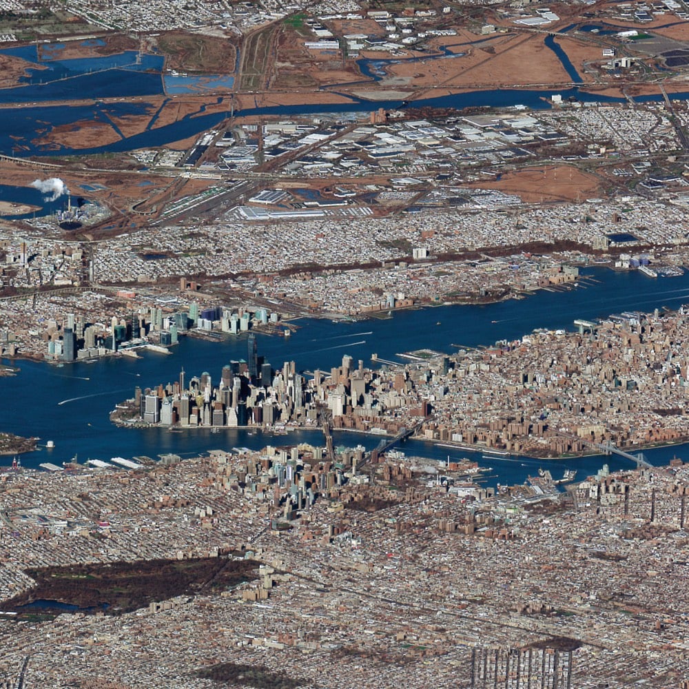
That’s much of Manhattan, Brooklyn, and Queens captured by Maxar’s Worldview-3 satellite, but at an unusually low angle. Here’s a closer view of the southern tip of Manhattan:
This particular shot is made possible due to the focal length of the camera in this satellite that is roughly 32 times longer than that of a standard DSLR camera.
I don’t know what practical value low-angle satellite photos have, but they sure are beautiful.
When astronauts look down at our planet and see its vibrant surface shining against the blackness of space, they experience the Overview Effect — a sense of awe, an awareness that everything is interconnected, and an overwhelming desire to take care of our one and only home.
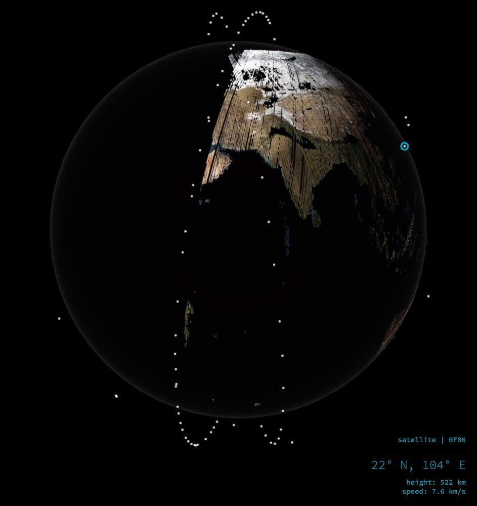
Every few seconds, the visualization picks a new satellite to track, allowing you to see the location, height, and speed. The satellites are 300 miles from the surface of the Earth moving at about 17,000 mph.
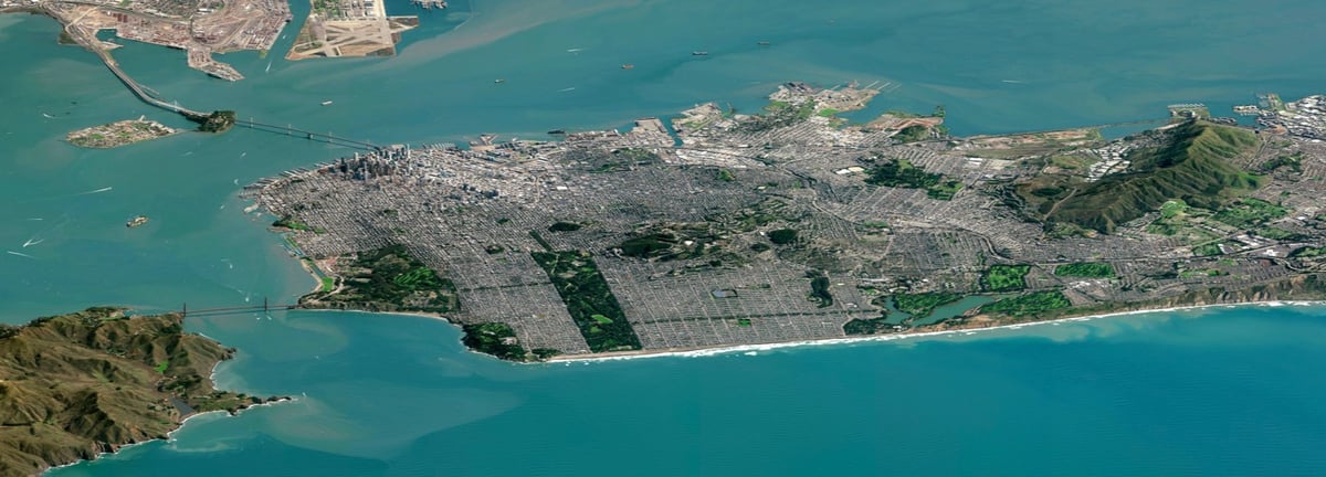
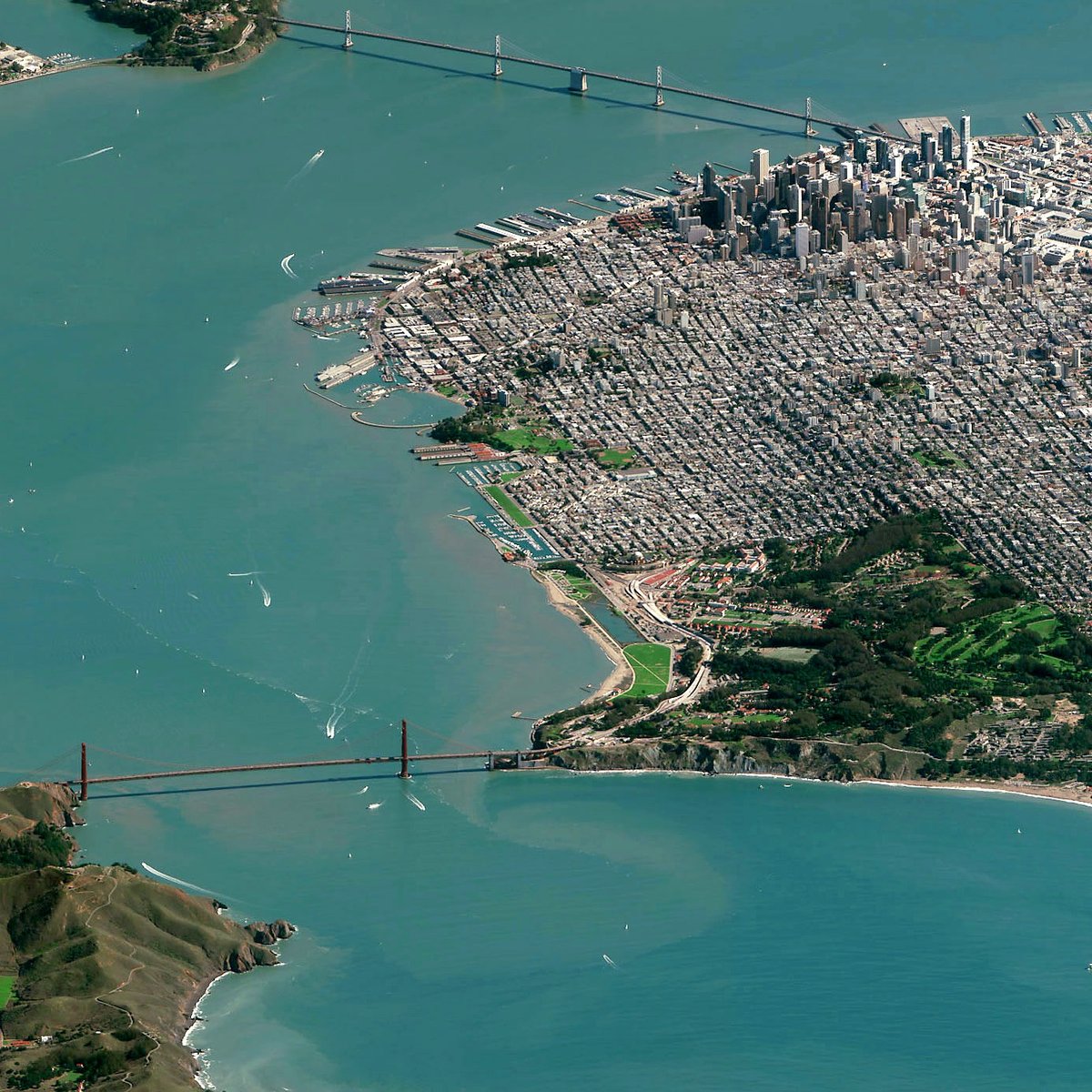
For practical reasons, satellite images are usually taken from straight overhead. But as this low-angle shot of San Francisco taken by DigitalGlobe’s Worldview-3 satellite illustrates, satellites are also capable of capturing more artful & surprising photographs of our planet. Due to the odd angle, it almost looks fake, computer-generated. Look at that toy Golden Gate Bridge connecting SimCity to a hyperrealist painting of the rugged California coast!
The image is worth seeing at full-resolution…you can find it at DigitalGlobe (they released it under a Creative Commons license) or Imgur. In the nearly full-res view of one slice of the map above, you can make out boats in the bay and even cars on the bridges.
Charlie Loyd of Mapbox explains how they captured such a crisp image:
We don’t often see pictures like this one. The problem is haze: as a camera in space looks toward the horizon, it sees more water vapor, smog, and other stuff in the atmosphere that obscures the Earth. But our friends at DigitalGlobe built WorldView-3 with a sensor suite called CAVIS, which lets it quantify and subtract haze - making atmospheric effects virtually invisible. Only WorldView-3 can see so clearly at this angle.
The use of satellite imagery has revolutionized many areas of science and research, from archaeology to tracking human rights abuses to (of course) climate science. This vantage point makes different sorts of observations possible than looking at ground level does.
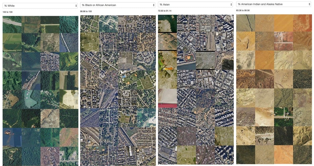
In what she calls “a work in progress”, Jia Zhang, a PhD candidate at MIT Media Lab, used census data to collect chunks of satellite images from areas with the highest concentrations of white, black, Asian, and Native American & Alaska Native people. The result is striking (but perhaps not surprising):
I’m looking forward to seeing more of Zhang’s work in this area.


Stay Connected