Depending on your vantage point, Manhattan seems either very big or very small. On complete map of the New York City area, Manhattan is dwarfed in size by the other four boroughs and surrounding megopolis. But for someone on the ground in Manhattan, the population density, the height of the buildings, the endless number of things to do, and the fact that many people don't often leave their neighborhoods, much less the island, for weeks/months on end makes it seem a very large place indeed. This divergence sense of scales can cause quite a bit of cognitive dissonance for residents and visitors alike.
A few months ago, I found an image online (which I cannot for the life of me relocate...any ideas? aha! it's from Bill Rankin's project, The Errant Isle of Manhattan) that worked to alleviate some of that dissonance. The image depicted downtown Chicago with Manhattan placed alongside it in Lake Michigan. I'd been to Chicago a few times and the image immediately gave me a better idea of Manhattan's true size.
A few weeks ago, I started to wonder how large Manhattan was compared to some other places I am familiar with. Hence, Manhattan Elsewhere. In the maps below, I've inserted Manhattan into places (at the same scale) that, through either habitation and visitation, I have come to know well. If you've been to Manhattan and some of these other places, I hope you'll find it as interesting to visualize these strange positionings as I have. Enjoy.
Chicago + Manhattan
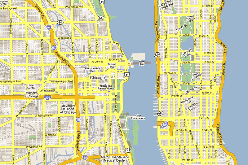
This is my version of the image that inspired this project. As with the other maps, Chicago is presented its original orientation and Manhattan has been rotated to match its profile. I didn't bother to connect any of the roads, but you can imagine the Lincoln Tunnel running under Soldier Field and hooking into the Dan Ryan somehow. Or further up and off the map, traffic heading over the George Washington Bridge to catch the Cubs at Wrigley or brokers commuting home, not to Westchester but to Winnetka or Highland Park.
Chicago + Manhattan, 3-D
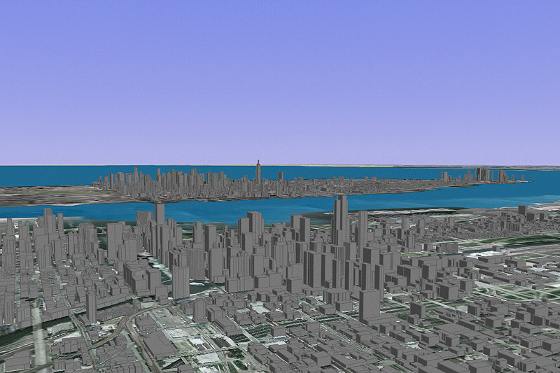
A three dimensional representation (courtesy of Google Earth) of the above map, looking over downtown Chicago and into Midtown/Lower Manhattan. The tall building just to the right of center in Chicago is the Sears Tower and you can see the Empire State Building in Manhattan breaking the curve of the horizon.
San Francisco + Manhattan
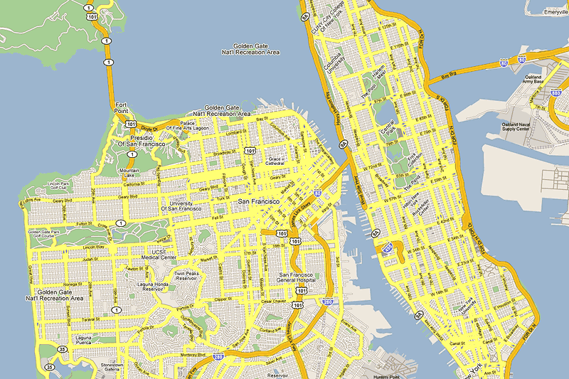
Here, Manhattan parks itself right in the middle of the Bay Bridge, taking the place of Treasure Island. You can see Alcatraz from Columbia. The view of Central Park from the Coit Tower would be lovely. Compare the sizes of the two cities' big parks; they look about the same.
San Francisco + Manhattan, 3-D
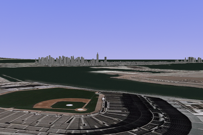
As before, a 3-D representation of the above map. The view is approximately from a seat in the upper deck of AT&T Park (formerly Pac Bell Park) behind home plate, looking east toward Midtown.
Boston + Manhattan
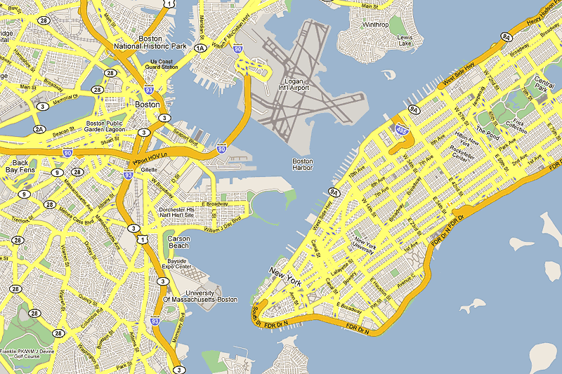
Manhattan clogs up Boston Harbor, displacing some small islands. That approach into Logan over Midtown looks a little scary and noisy for Chelsea residents. The downtowns are quite far from each other...I wanted to avoid modifying Boston's layout too much and not remove the airport.
Minneapolis + Manhattan
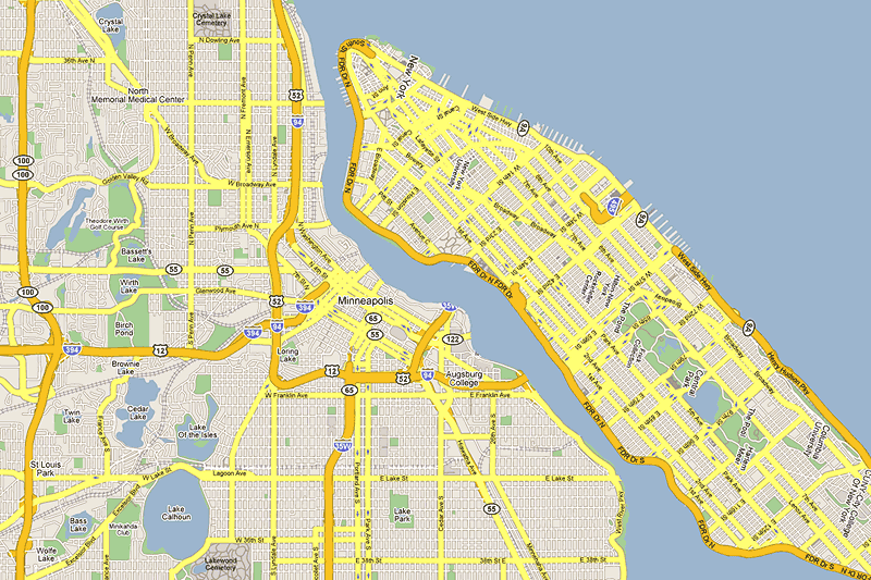
This is the most unsatisfying map of the bunch. That pesky Manhattan just wouldn't fit cleanly into the Mississippi without a ton of modification, so I just made a sixth Great Lake out of the area including Northeast Minneapolis and St. Paul. Sorry, St. Paul. Also, the Twin Cities metro area is quite large for its population, which is a polite way of saying "urban sprawl".
Barron, WI + Manhattan
This one's primarily for me and my folks. I lived in Barron, WI in my middle/high school years. Barron is located in northwestern Wisconsin and has a population of around 3,000 people. I made a lake of the area just to the west of town and plopped Manhattan in it. I'm surprised to see how wide Barron is compared to Manhattan...it seemed so much smaller as a kid.
Published on June 1, 2006. Last modified on June 1, 2006. Map imagery by Google Maps and Google Earth. Inspired by Bill Rankin's project, The Errant Isle of Manhattan, part of his excellent Radical Cartography site.