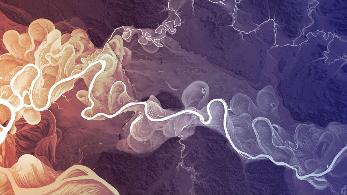


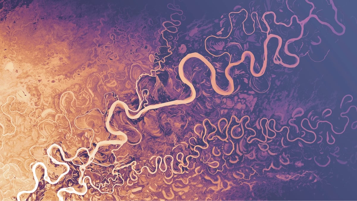
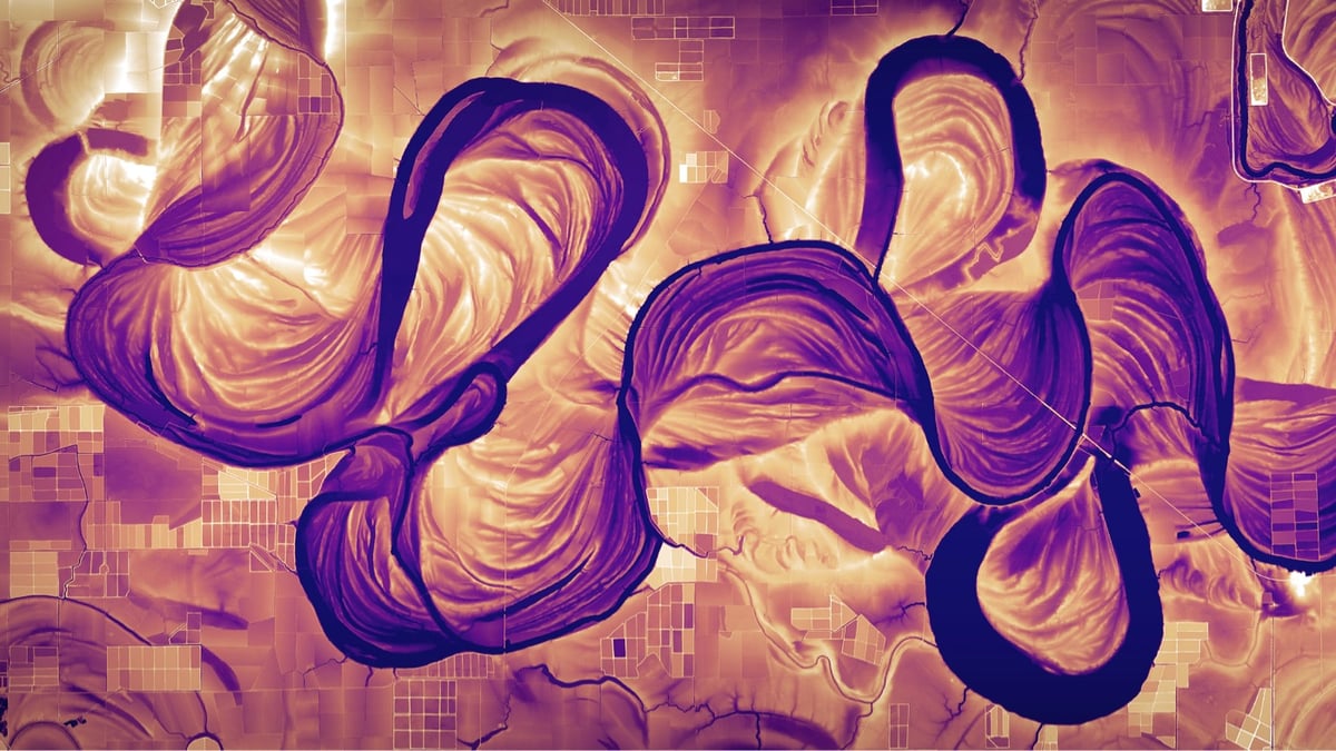
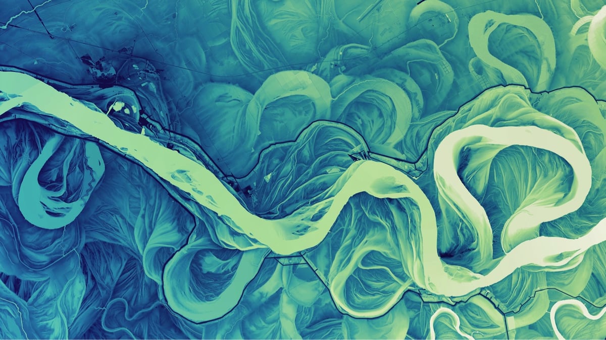
I cannot get enough of Dan Coe’s high-resolution images of rivers and river deltas constructed from lidar data. So swirly, swoopy, fractally, and squiggly! Many of these images are time machines, showing the various meanders these rivers took hundreds and thousands of years ago. As I wrote in a post about the Mississippi River meander maps designed by Army Corps of Engineers cartographer Harold Fisk:
Fisk’s maps represent the memory of a mighty river, with thousands of years of course changes compressed into a single image by a clever mapmaker with an artistic eye. Looking at them, you’re invited to imagine the Mississippi as it was during the European exploration of the Americas in the 1500s, during the Cahokia civilization in the 1200s (when this city’s population matched London’s), when the first humans came upon the river more than 12,000 years ago, and even back to before humans, when mammoths, camels, dire wolves, and giant beavers roamed the land and gazed upon the river.
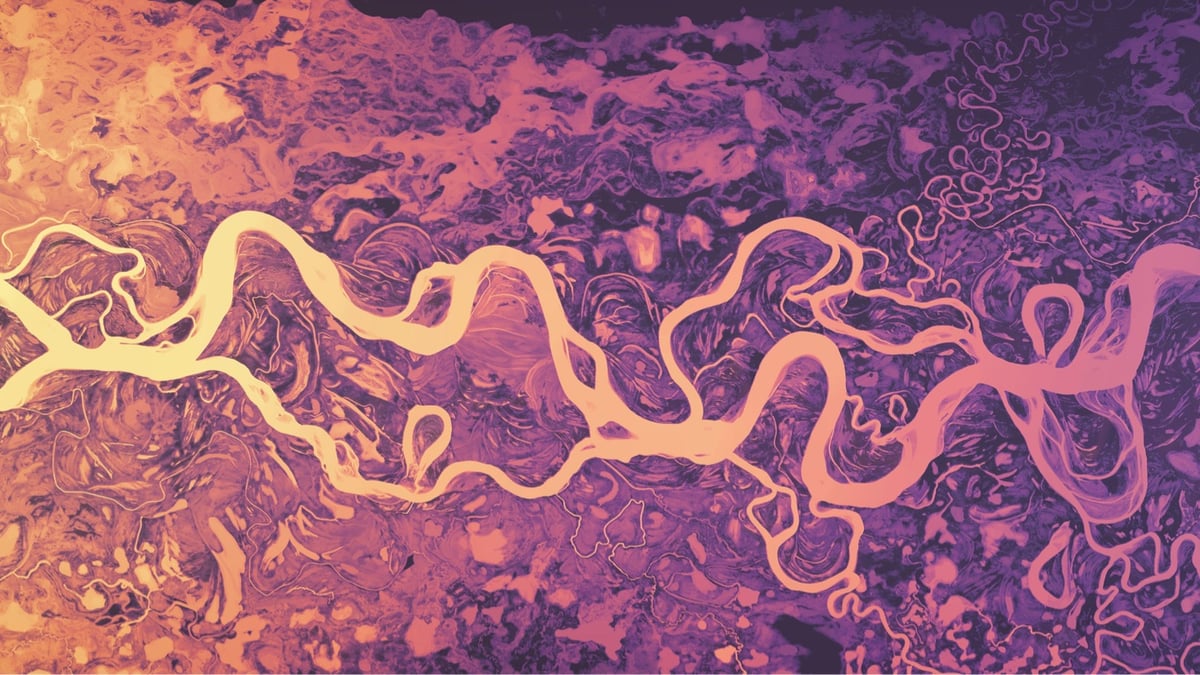
Coe has put 4K versions of these images up on Flickr in both landscape and portrait aspect ratios. They work really well for computer and phone wallpapers — I’ve been using this one on various devices since I first saw it years ago.
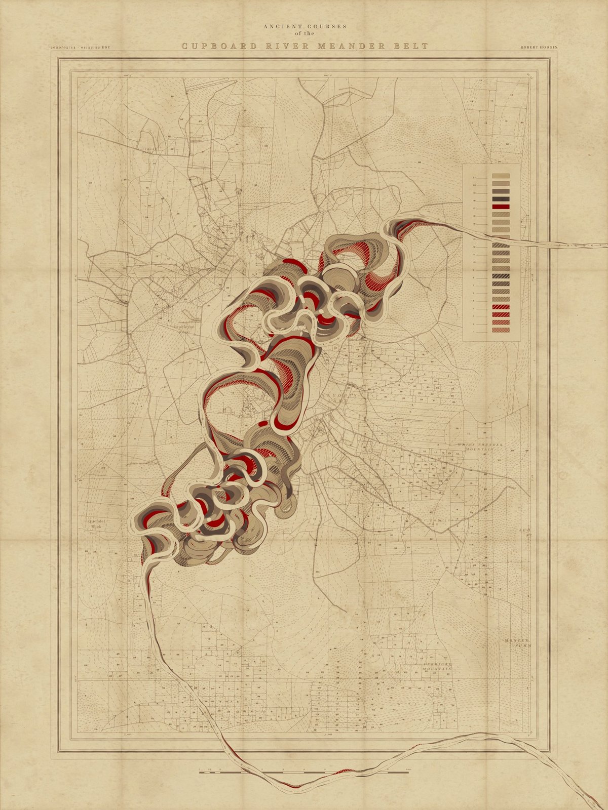
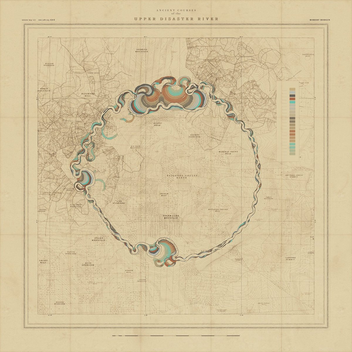
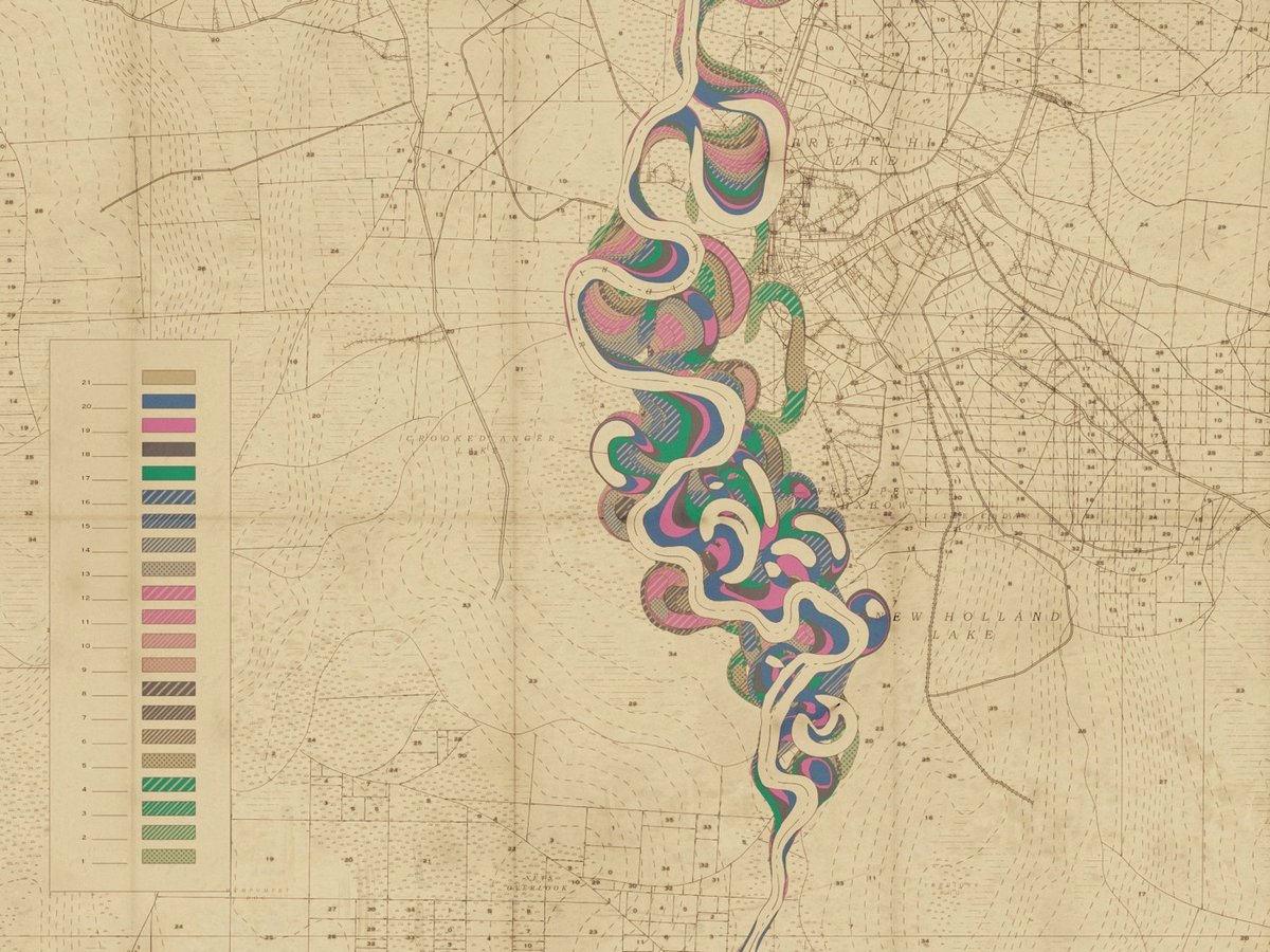
I have written previously about cartographer Harold Fisk’s wonderful meander maps of the Mississippi River produced for the Army Corps of Engineers. Borrowing the aesthetic of these maps, interactive artist & engineer Robert Hodgin wrote some software called Meander to generate meander maps for fictional rivers.
From an input curve, the terrain, land plots, side roads, highways, marsh land and mountain peaks are generated and prominent features are named. The map is then weathered and rendered in the style of old US Army Corp of Engineers maps from the 1930s and 40s.
You can check some of the generated maps out on Twitter or on Instagram, including some prototypes and animations (this one is my favorite). Hodgin has promised a full write-up of the project; I’ll link to it when he publishes it.
Coincidentally, while I was writing this post I got an email from a reader about an audiovisual installation called Meandering River that displayed “real-time visuals generated by an algorithm and music composed by an A.I.”
Synchronicity!
Update: Hodgin wrote about the Meander project on his website and included several more gorgeous examples of his output.
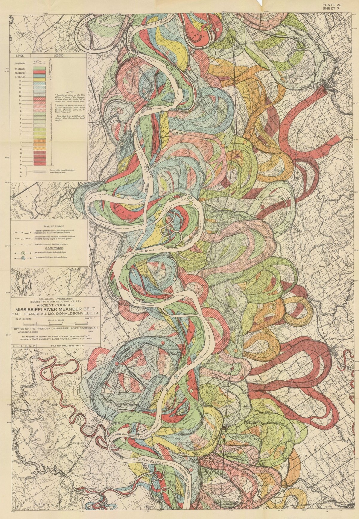
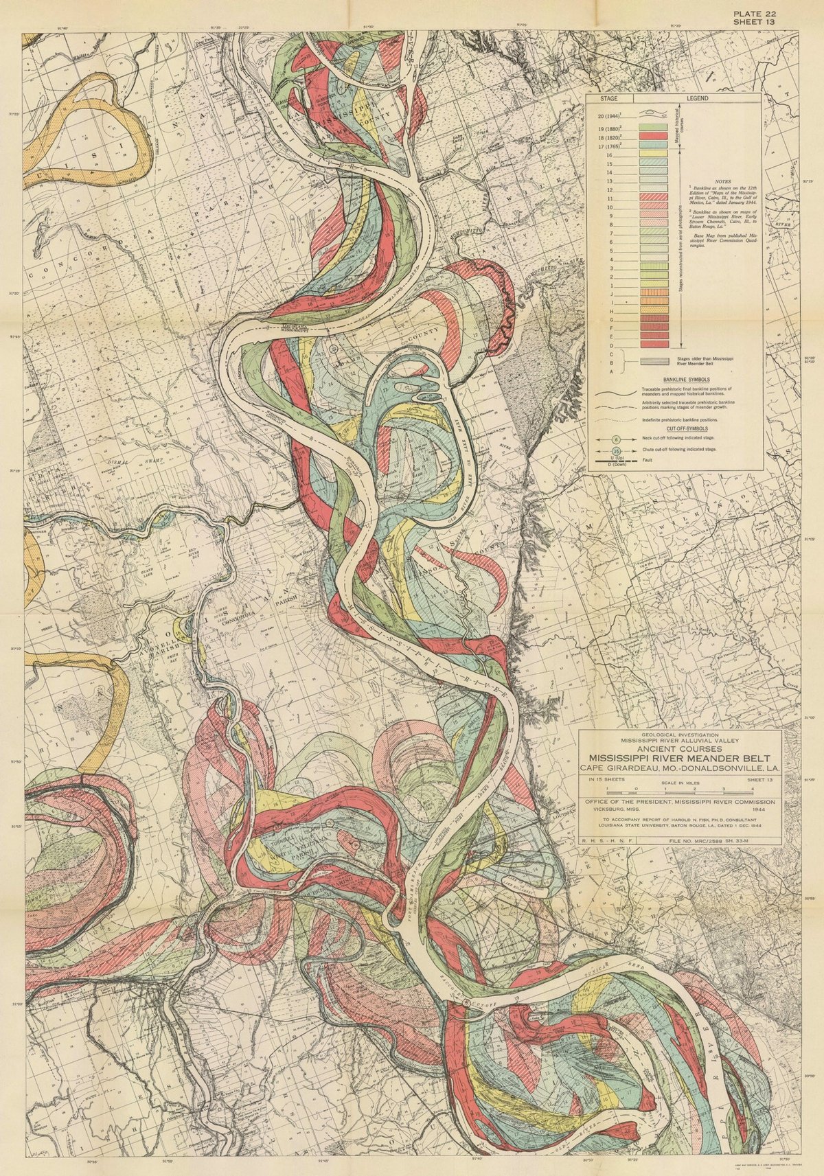
I have long admired the Mississippi River meander maps designed by Army Corps of Engineers cartographer Harold Fisk but have somehow never written a whole post about them. So when my pals at 20x200 reached out wanting me to write a blog post for them about their Fisk prints, I jumped at the chance. It gave me an excuse to write about art as time travel and, in particular, how Fisk’s clever map compresses thousands of years of a river’s activity into a single image.
It takes some imagination, but standing before a painting by Hilma af Klint, a sculpture by Bernini, or a cave painting in Chauvet, France draws you back in time in a powerful way: you know you’re standing precisely where those artists stood hundreds or even thousands of years ago, laying paint to surface or chisel to stone. Even experiencing art through prints or photographs leads the mind to consider all the cultural, political, technological, and economic things that were happening when the work was produced. Art is a doorway to past worlds.
Fisk’s maps represent the memory of a mighty river, with thousands of years of course changes compressed into a single image by a clever mapmaker with an artistic eye. Looking at them, you’re invited to imagine the Mississippi as it was during the European exploration of the Americas in the 1500s, during the Cahokia civilization in the 1200s (when this city’s population matched London’s), when the first humans came upon the river more than 12,000 years ago, and even back to before humans, when mammoths, camels, dire wolves, and giant beavers roamed the land and gazed upon the river.
You can buy prints of Fisk’s maps at 20x200…they have several available at all kinds of different sizes, framed and unframed.
Update: With LIDAR, the past meanderings of rivers can be seen more clearly (and no less artistically) than in Fisk’s maps. Here’s a LIDAR image of the Mississippi River along the border of Arkansas and Mississippi:
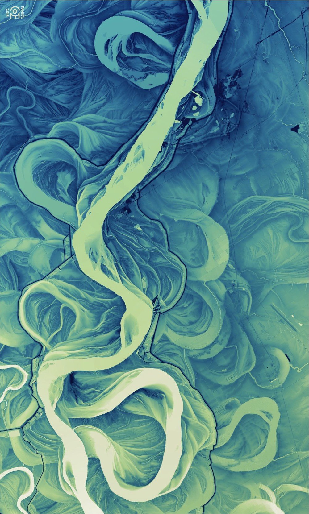
And don’t miss Daniel Coe’s morphing GIF of Fisk’s map to the LIDAR image. (via @macgbrown)
Update: Ahhh, look at this meander quilt from Timna Tarr:
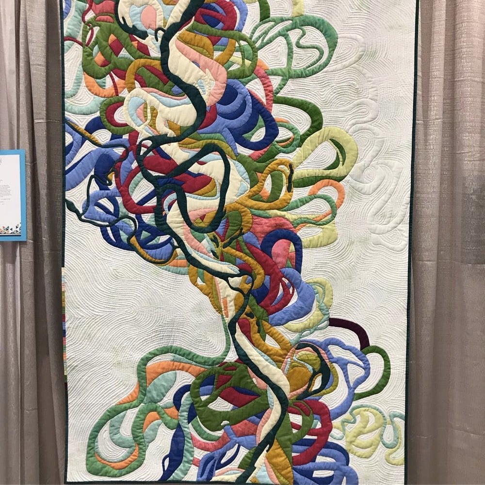
And check out some of the other quilts in her gallery…very cool. (thx, rachel)
Update: Cathy Fussell has also created quilts based on Fisk’s maps.
I don’t know if this needs a disclaimer or not, but 20x200 paid me a modest amount to write this blog post for their site but not the post you’re reading now. 20x200 didn’t pay me to write this here post; they didn’t even ask me if I would link to their post from my site. I once wrote a slightly longer (and progressively unhinged) disclaimer for a previous post about 20x200.
Socials & More