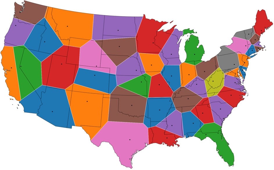
From Jason Davies, this is a US map where the state borders have been redrawn so that all points closest to a state capital than to any other form a state a la Voronoi diagrams. See also Voronoi maps of world airports and world capitals.
It’s interesting that many of the states’ new shapes are similar to their current ones, suggesting that the placement of the capitals relative to borders was somewhat naturally Voronoi-esque, like how people naturally space themselves in elevators or parks.
In a book called Atlas of the World with Geophysical Boundaries, scientist Athelstan Spilhaus published a series of world maps that emphasized the Earth’s oceans over the continents. The maps turn our familiar continental view of the world inside out. Check out this rendering of one of Spilhaus’ maps by Le Cartographe:
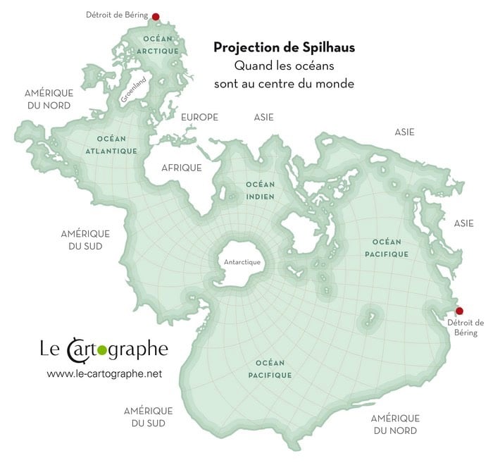
Takes a second to get your bearings on that, right? One big ocean with Antarctica in the middle, surrounded by the stretched-out landmasses of Asia and the Americas. Jason Davies recreated some of the other Spilhaus maps and so did Mike Bostock.
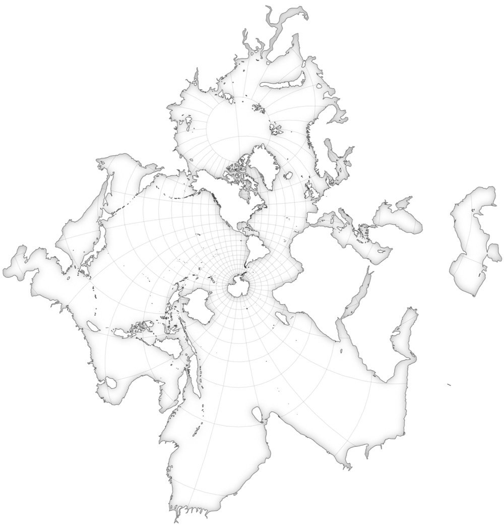
You can see a bunch of Spilhaus’ other shoreline maps by flipping through the pages of his book on Google Books.
Socials & More