Incredible Satellite Images of the Latest Volcanic Eruption in Iceland
Archaeologist and satellite expert Marco Langbroek posted a satellite image of the latest volcanic eruption on Iceland’s Reykjanes Peninsula, near the city of Grindavik.
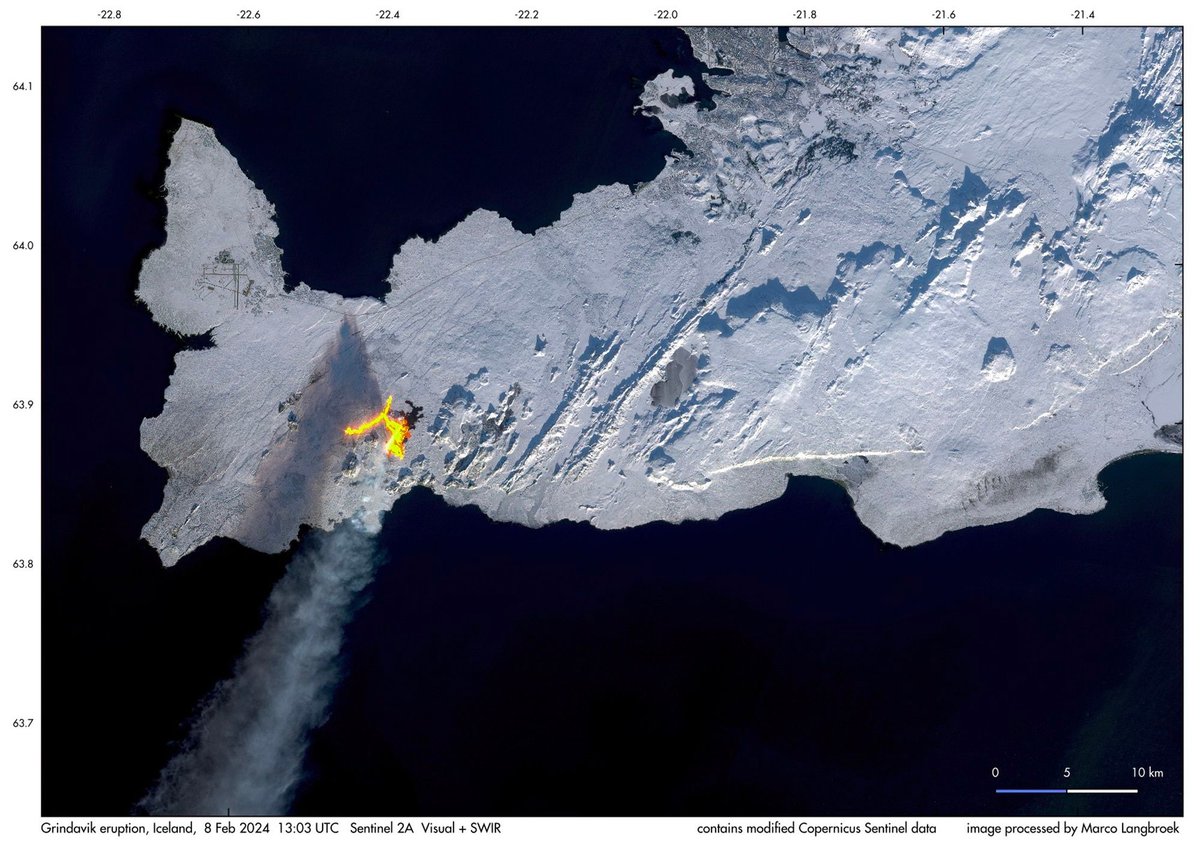
Wow. It’s worth clicking through to see it larger (mirrored here). You can see the Keflavik airport to the northwest of the fissure and Reykjavík is the darker area in the upper part of the image, just right of center. This image really underscores the extent to which volcanoes are fiery, slashing cuts to the Earth’s skin. It’s bleeding! Bleeding lava!
This image was taken by the European Union’s Copernicus Sentinel 2A satellite and processed by Langbroek. The Copernicus project posted their own view of the volcano today as well:
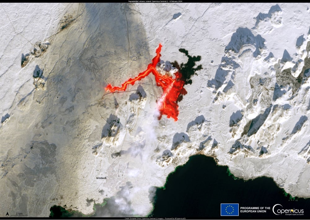
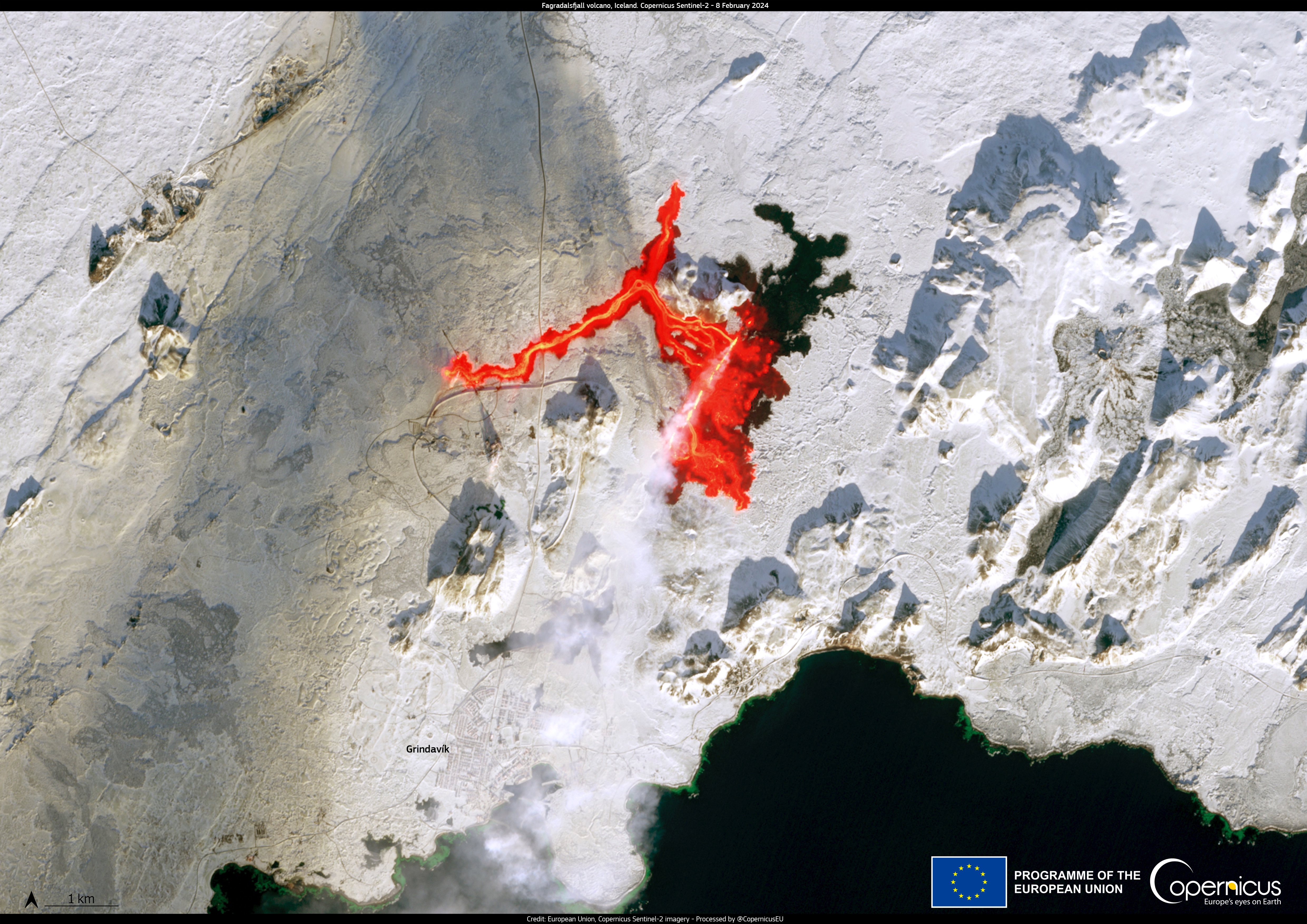
Again, worth seeing larger. And here’s a closeup view of the fissure.
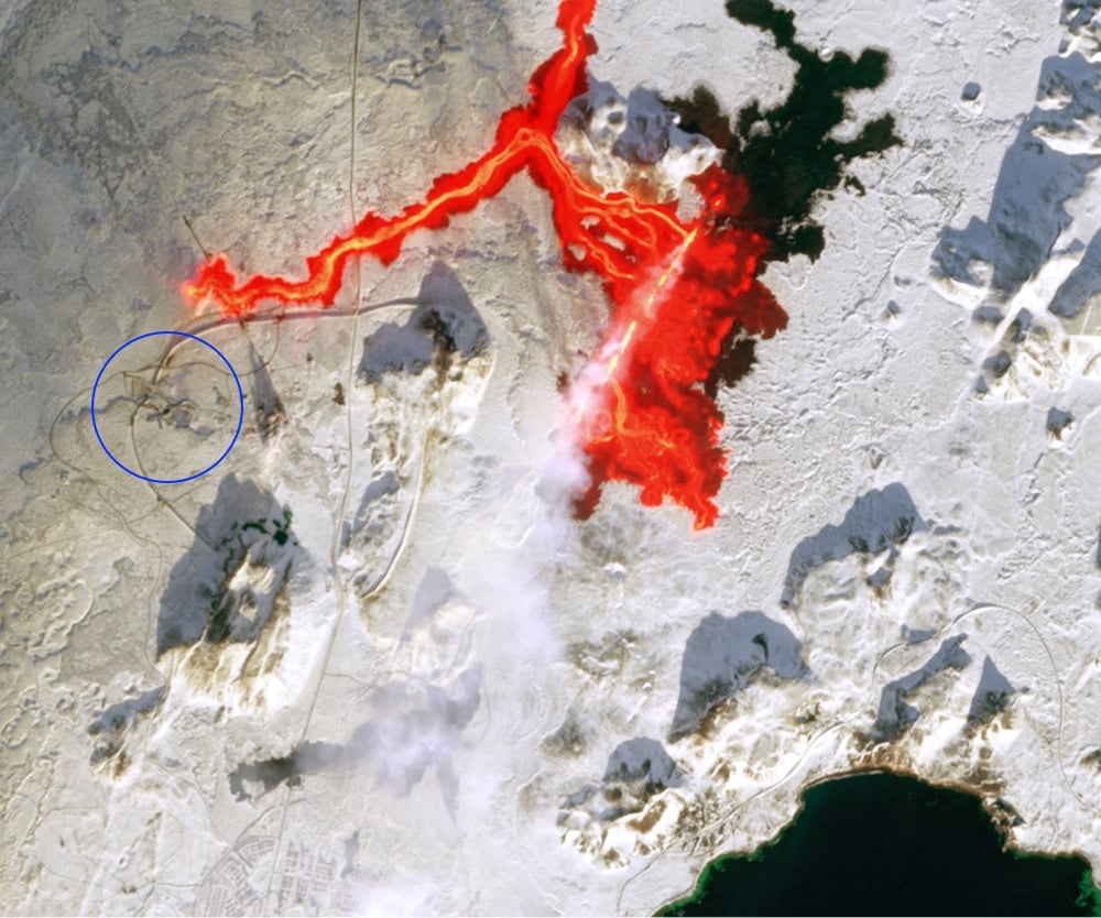
The famed Blue Lagoon spa, circled in blue, is very close (less than a mile) to the lava flow and is currently closed.
If you want to check out the satellite imagery for yourself, you can find it on Copernicus Browser. I tried for a few minutes to duplicate Langbroek’s view (“combined natural colour + SWIR”) but couldn’t quite manage it.
Stay Connected