A subway-style map of the Roman roads of Britain
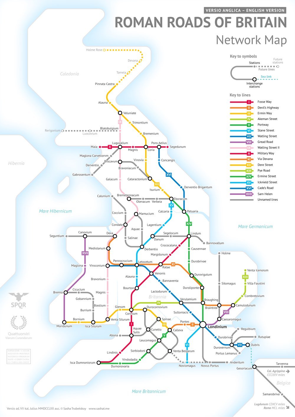
After completing his subway-style map of the roads of the entire Roman Empire, Sasha Trubetskoy began work on a highly requested follow-up: a similar map of the Roman roads in Britain.
This was far more complicated than I had initially anticipated. Not only were there way more Roman Roads in Britain than I initially thought, but also their exact locations and extents are not very clear. In a few places I had to get rather creative with the historical evidence.
As Wikipedia notes, most of the roads were completed by 180 AD and many of them are still in use today.
After the Romans departed, systematic construction of paved highways in the UK did not resume until the early 18th century. The Roman road network remained the only nationally-managed highway system within Britain until the establishment of the Ministry of Transport in the early 20th century.
Socials & More